Weitere Abbildung
Weitere Abbildung
Weitere Abbildung
253
Atlanten
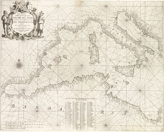
Levanto, Prima Parte dello Specchio del Mare, 1664.
Schätzung:
€ 18.000 Ergebnis:
€ 14.400 (inkl. Käuferaufgeld)
Atlanten. - Levanto, Francesco Maria,
Prima parte dello Specchio del Mare, nel quale si descrivono tutti li porti, spiaggie baye, isole, scogli, e seccagni del Mediterraneo .. Non mai piu cosi ampiamente descritto, & arricchito di Carte Maritime nuovamente costrutte. Genua, G. Marino und B. Cele 1664.
Erste Ausgabe. - Seltener Mittelmeer-Seeatlas, von dem nur der vorliegende erste Teil erschienen ist. "Little is known about its author, but the work displays a strong Dutch influence, particulary in the style of the Van Keulens." (Nat. Maritime Mus. Cat.) - Italienische Übersetzung von P. Goos' Straets-Boeck von 1662 mit den Karten in der Überarbeitung von F. M. Levanto, der schöne Kupfertitel wiederum ist eine spiegelverkehrte Kopie des Titels von Goos' Zee-Atlas. - Die überaus zahlr. Holzschnitte im Text zeigen Navigationsinstrumente, Küsten- und Hafenkarten und vor allem Hunderte von Küstenaufrissen. Im anschließenden Kartenteil folgen dann die schönen gestochenen Küsten- und Inselkarten. - "Ein Handbuch, das sogleich bei See- und Steuerleuten beliebt war. Es war das Ergebnis einer 20jährigen Navigationserfahrung in diesem Raum." (LGK II, 503) - Vorsichtig gereinigtes Exemplar. Vereinz. leichte Knickspuren und hinterl. kl. Einrisse im Rand, 2 Karten im Falz verso verstärkt, 2 Karten unten mit kleinen Randläsuren, ansonsten von sehr guter Erhaltung mit den Karten in schönen kräftigen Abdrucken.
EINBAND: Pgt. unter Verwendung alten Materials. Folio. 2 Bll., 152 S. - ILLUSTRATIONEN: Mit breiter gest. Titelbordüre mit kl. Seegefechtsszene und 25 gefalt. Kupferkarten sowie zahlr. Textholzschnitten.
LITERATUR: Koeman Lev 1. - Phillips/Le Gear 7858. - Nat. Maritime Mus. Cat. III/1, 42. - LGK I, 349 (irrig mit 28 Ktn.). - Nicht in der Crone Library und im Scheepvaart Museum.
First edition of the sea atlas of the Mediterranean. Italian translation of Goos' Straets-boeck from 1662, the maps reworked by Levanto. With illustrated engr. title and 25 folding copper maps as well as numerous woodcuts in the text, depicting coast lines etc. Vellum rebacked retaining old material. - Carefully washed copy. Only here and there with marginal creases or rebacked tears, 2 maps rebacked in the folds, 2 maps with slight marginal defect, otherwise fine copy with the maps in strong impressions.
Weitere Informationen
Empfehlen
 +Link zum Teilen
 +Link zum Teilen
253
Atlanten
Levanto, Prima Parte dello Specchio del Mare, 1664.
Schätzung:
€ 18.000 Ergebnis:
€ 14.400 (inkl. Käuferaufgeld)
Weitere Informationen
Empfehlen
 +Link zum Teilen
 +Link zum Teilen

Ihre Lieblingskünstler im Blick!
- Neue Angebote sofort per E-Mail erhalten
- Exklusive Informationen zu kommenden Auktionen und Veranstaltungen
- Kostenlos und unverbindlich


 Lot 253